Cedar Butte


Cascade Foothills: Cedar Butte
Cedar Butte, A Nice Four Seasons Trail
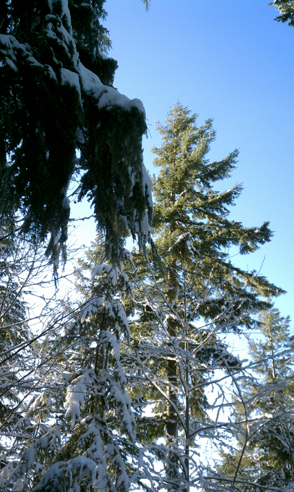
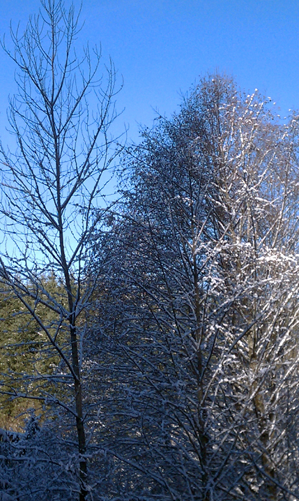
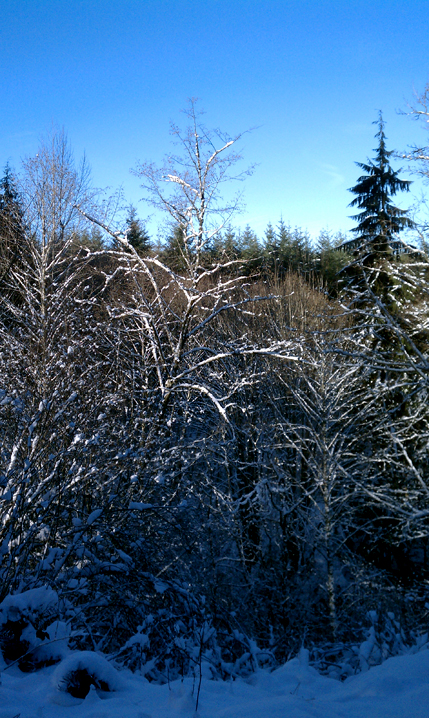
The Cedar Butte trail is just a little more than thirty-five miles from Seattle and since it's starts at only about 1,000 feet up in elevation, it is pretty much a year-round hike to enjoy. That's not to say there won't be snow there at times during some seasons. But the snow depth is usually quite manageable for any decent, waterproof hiking boot. Such was the case on the last day of 2010. December 31st was another day that highlighted the many reasons for living and hiking in the Great Northwest. Blue skies and sunshine hitting the glimmering snow that covered the evergreens and ground. It was a cold, fresh, fluffy snow and with the freezing temperatures it refused to melt on this day.
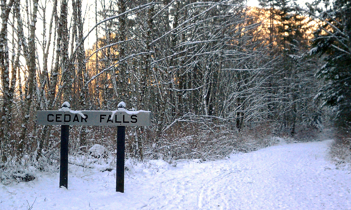
Finding the Cedar Butte trailhead requires a little maneuvering. After turning off Cedar Falls Road, there are several parking areas, the first of which are for the Rattle Snake Lake Recreation area and the trailhead for the busy Rattlesnake Ledge. Continue driving past these first lots and on the left go up to a parking area closer to the trailhead. There is a public restroom for any final business to take care of.
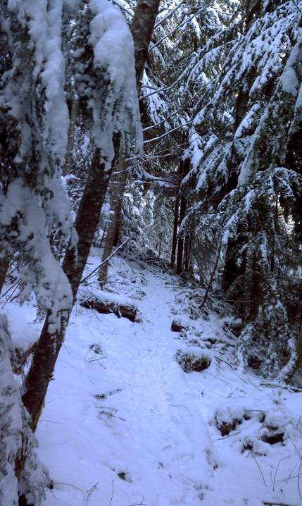
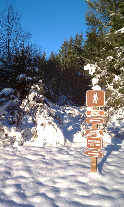
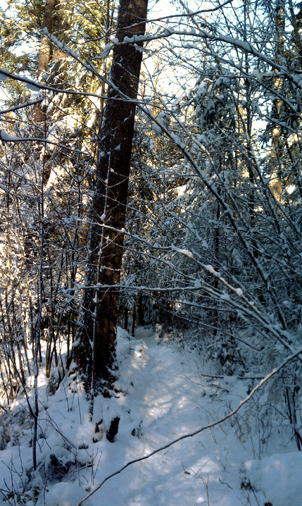
The trek begins on the John Wayne Pioneer Trail, which is an old railroad track from many years ago and is now a wide trail. Within a few minutes, we noticed Christmas Lake through the trees on our left...although barely visible. In three-quarters of a mile or so, we cross on a minor bridge over Boxley Creek and soon to the right is a sign for the true beginning of the Cedar Butte Trail. We head up.
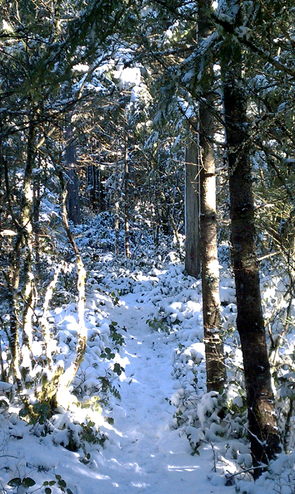
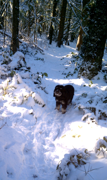
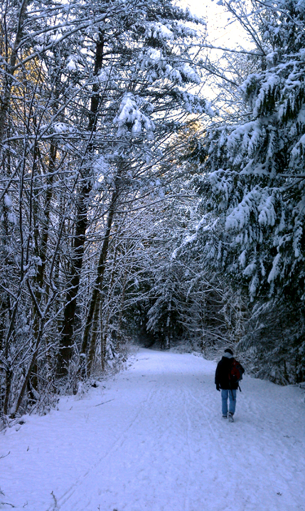
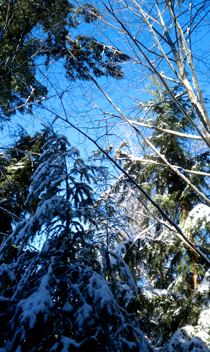
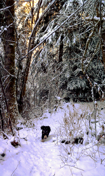
Even though the skies are clear, the sun is still very low in the sky and the tall evergreens, being covered with a couple inches of snow, make the forest hike rather dark at times. The snow isn't deep, and we can see the footprints of other boots that help mark the way. With the branches weighed down by the snow, sometimes we need to duck over larger ones that are sagging over the trail. More than once I brushed a little too close and a pile of snow went down my neck. At about a mile into the hike, and not very well signed, the options are to continue straight up on the "old" Cedar Butte trail, or veer right on the newer one. I've done both at one time or another. Turning to the right, this trail is definitely easier and gets you to the same destination...and I think is even a bit more enjoyable. Take the other one back down.
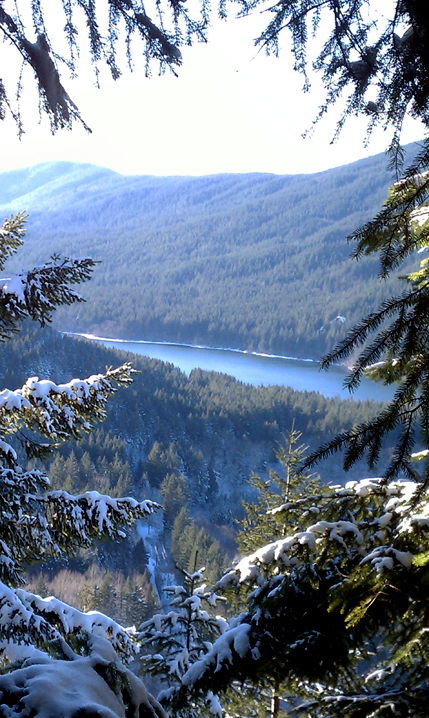
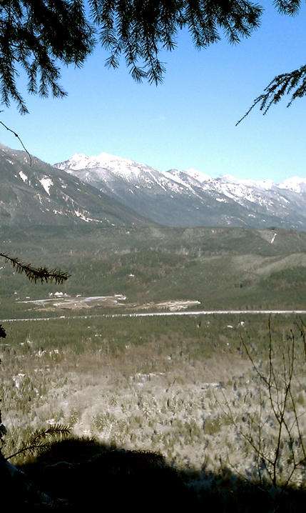
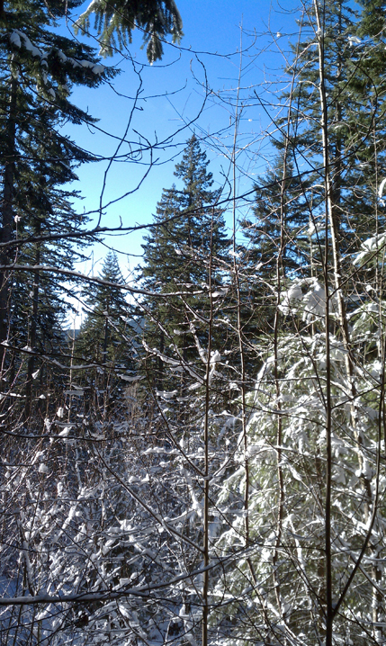
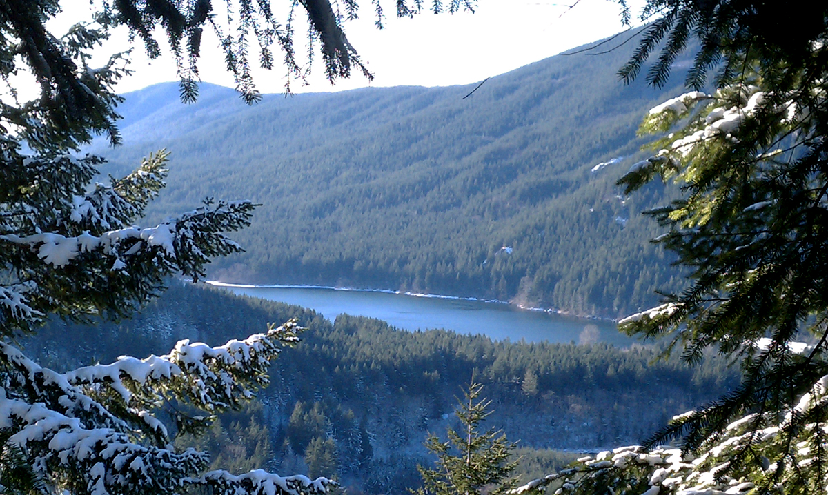
In a short period of time, we reach the signpost telling us we are at the Boxley Blowout Overlook. Even in the wintertime, with less shrubbery, this is barely a viewing area. But, down below the cliff, is the place where the Cedar Reservoir blew out, almost a hundred years ago. From here, you'll see signs pointing you to the "summit". Less than a half mile from the summit is the Saddle Junction sign, where the other trail option hooks up with the one we took. From here we begin a bit steeper climb with a few switchbacks. Although there aren't many viewing areas, we do run into one on the way up looking toward Rattlesnake Mountain and the lake below. I stop, take a picture and continue the short distance remaining to the summit.
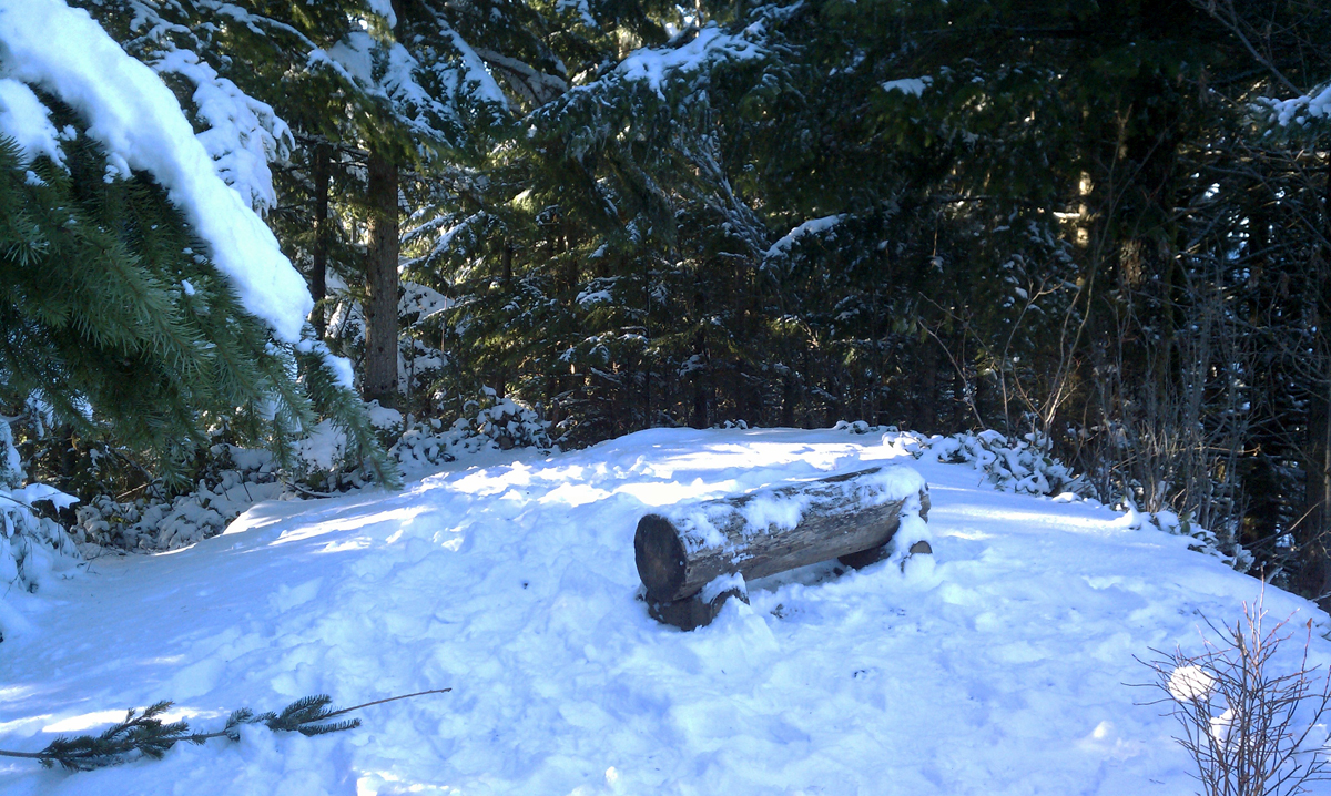
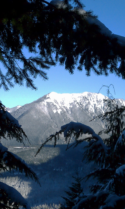
Once reaching the top, it's a surprisingly small area in which to maneuver for the overlook views. It has one log of which to sit on and enjoy the view across the Snoqualmie River Valley looking North and East...Mount Si, Little Si, Mailbox Peak and Mount Washington. On this New Year's Eve day, we shared it with another couple that came up five minutes behind us. Each of us enjoying our trailmixes, water, the view and a bit of holiday greetings to each other...and then we head back down. At the Saddle Junction, you can either go left and head back the way you came, or go straight back down on the old trail. Might as well go a different way down!
This is not a difficult trail. Two miles up, four miles round-trip. The hiking elevation gain is about 900 feet, so by the time you reach the top you're at the 1,900 foot level. I've hiked this trail several times in all seasons and have never run into many other people. I've seen the parking lots pretty full in the summertime, but there are so many trail options that the Cedar Butte Trail is still a nice getaway...especially in the wintertime when I'm looking for a good lower elevation hike.
Cedar Butte Trail: Quick Points
Coming from Seattle, head east on Interstate 90 and take exit 32 in North Bend. At the end of the off-ramp, turn right on 436th Avenue SE. This road becomes Cedar Falls Road. Continue about three miles until you see a grouping of parking lots on the right.
There are quite a few parking areas here. The first that you see are actually for the Rattlesnake Lake Recreation Area. If you continue past these, you will see other parking areas on the left that are part of the Iron Horse State Park and bring you closer to the trailhead you seek. Start at the John Wayne Pioneer Trail. This trail used to be a railroad, which is why it is wide. In less than a mile, after crossing the bridge over Boxley Creek, look to the right for the beginning of the Cedar Butte Trail. Shortly into the trail, although I didn't see a signpost, you can keep going straight up on the original trail or turn right for a bit easier climb.
It is likely to be more crowded on weekends than it is during the week because it is so near the city. In the winter months though, you'll have quite a bit more solitude.
Follow Us on Twitter - twitter.com/trailsnorthwest
Cedar Butte